BEECHWORTH & DISTRICT
MOUNTAIN BIKE TRAILS
DOWNHILL
Mount Stanley Downhill
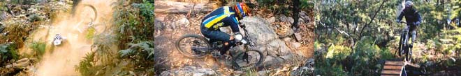
The Mount Stanley DH course is Australia's biggest and
certainly one of the most challenging. A 6km course with a vertical drop
of 730 metres ! An infamous rock garden, sweet singletrack and fast
fireroad thrown in for variety. The start of the downhill course at Mount
Mount Stanley is 19km from Beechworth. Advanced riders only !
(Click image above for more information)
"Woolshed Track"
This is a cross-country friendly downhill track which is around 3km long
and is a mix of very cool singletrack and firetrail. You can find the main lower
part of the trail from the junction of the Wodonga and Chiltern Roads.
Look below on the roadside reserve. The bottom of the track comes out
onto the Beechworth-Chiltern Rd just about 100m downhill from and
opposite the turnoff to "Woolshed Falls" (Mc Feeters Rd). Look for the
Parks Victoria "Woolshed Valley" interpretative sign. This is where the track ends.
CROSS-COUNTRY
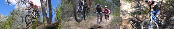
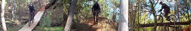
Beechworth Mountain Bike Park
Finally an area the club can use dedicated to mountain biking, thanks to
the support of the Indigo Shire Council. A network of singletrack, a fun
jump park, North Shore and more. The trails are marked out as a loop with
options for 'easier', 'more difficult', 'advanced' and 'expert' tracks.
Get out there and explore the trails. To find the trail head drive out along
High Street from the centre of town (heading East towards the Football Oval)
for 2.5km (road turns to dirt and becomes Alma Rd). Look for the big
Beechworth Mountain Bike sign on your left on the corner of Alma and
Greenwattle Roads. Simply follow the trail signs to ride the
'Cross Country Loop' and/or the 'Jumps Track'. Check out the
photo gallery for some pics of riding at the MTB Park. Currently over 8km of
singletrack and counting ! Click here to see the Beechworth
Mountain Bike Park map. This is a good area to ride in the wet.
(Click image above for more information)
Everton Pines Trails
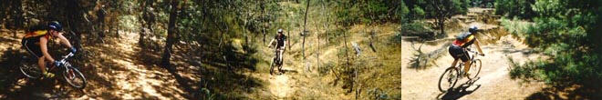
A network of singletrack in the pine forest in Everton off Diffey Rd (10km south of
Beechworth) and next to the Rail Trail. Ride for an hour
and stay totally on singletrack ! A XC State Round race was held here in
February 2003. Click here for details from this event (including a location map).
The pine needle covered trails are still there so get out and enjoy them !
Update (June 2005)- The trees and weeds across the tracks had mostly been
cleared up but now the Logging trucks have been in thinning out the pines.
Best to leave this area alone for a while and see how much of a mess is left !
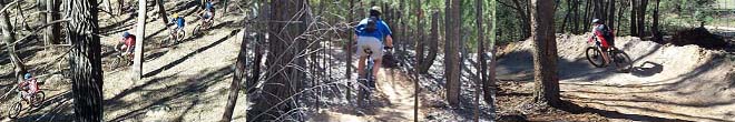
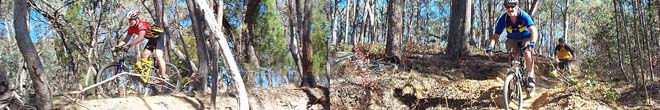
Rowdy Flat (Yackandandah)
An old mining area littered with great singletrack. To get to the trails at Rowdy
Flat, drive out of Yackandandah towards Wodonga and turn right onto
Racecourse Rd. Follow Racecourse Rd for about 2km and take the first road
(dirt) on the right (opposite Wildon Ave). Drive through to the open clearing area
(just before the creek crossing) and park the car. Ride the vehicle track that fords
the creek then head uphill for about 40 metres until you see some singletrack on
the right. Follow this uphill and explore the singletrack and mining trails in the area.
It's not too big so you can't really get too lost. Check out this photo gallery
page for some pics of riding at Rowdy Flat. Tracks get very greasy in the wet.
(Click image above for more information)
Mountain Bike Gold Rush (point to point rides)
The club runs two annual classic point to point mountain bike rides, the Mountain
Bike Gold Rush events. There's the Beechworth-Yackandandah event in Autumn
and the Beechworth-Eldorado event in Spring. To ride these trails socially at
other times, here is a basic list of the tracks used on both courses. It is essential
that you buy a more detailed map, available in town if you are unfamiliar with the
course and the area. We hope to have a downloadable map of the Gold Rush
courses available on the website soon. Remember that unless you plan on riding
back to Beechworth, these rides are a one-way point to point ride. Arrange a
car shuttle or have someone pick you up !
(Click image above for more information)
Beechworth Historic Park (Parks Victoria)
Click here to download Beechworth Historic Park, Park Notes/Maps (pdf file, 730kb)
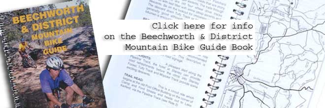
Beechworth & District Mountain Bike Guide Book
Sample ride description + map (Ride 7 | Stanley-Mopoke Track)
Click here to download Ride 7 | Stanley-Mopoke Track description (pdf file, 88kb)
Click here to download Ride 7 | Stanley-Mopoke Track map (pdf file, 48kb)
Other Mountain Bike Destinations in the area
BRIGHT (35min drive) - Some great flowing XC singletrack and technical trails along the
Ovens River (Cherry Walk), Baker's Gully Reservoir and pine forest area, a XC trail
off from Valley View Walk and the Wandiligong Walk. For DH junkies try Mystic DH
from the launch site (paragliding/hang gliding) off Mystic Mountain.
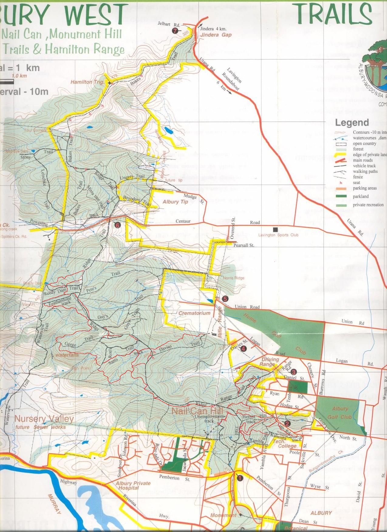
ALBURY (35min drive) - Nail Can Hill, a plethora of singletrack !! Just explore the trails
off of the main Ridge Track closed to vehicles. Click here for a map of the trails.
MOUNT BEAUTY (1hr drive) - Home of the Nationals and really great MTB'ing for both
XC and DH including the Big Hill and Mt Beauty short courses. The ride down
the Survey Track from Cranky Charlie (5km up the Falls Creek Rd) is a blast !
